


BRW Bonus: Hiking Through Westchester County II—Baby I Love Your ‘Way
The Bronx River Pathway, complete with waterfalls, new towns to explore, and another dam, all while following a river.

When I hiked the Old Croton Aqueduct trail in Westchester County, New York last year, I never guessed it would awaken a yen in me for hiking. In July I completed another Westchester trail, close to Metro-North, and headed by a dam.
This one was a different experience.
The Bronx River Pathway lies further inland of lower New York State, maybe halfway between the Hudson River to the west and Connecticut to the east. It entwines with the Bronx River and the Bronx River Parkway, a limited-access highway.
The River’s source, at the north end, is the reservoir at the Kensico Dam. Completed in 1917, it, like the OCA, was created in the late nineteenth century to provide water for a growing New York City.
The River and Pathway are part of a greenway. It follows the Harlem line course of Metro-North and the Parkway. Its ultimate purpose is to connect all the parks of the River.
There are JPEGs of the trail online, though the OCA map made by Friends of the OCA was much better. The Pathway map I used helped in the beginning, but I didn’t need it. The trail had signs. Also, unlike the OCA trail, the Pathway is paved. As part of the greenway, it didn’t veer off course into active streets. The FOCA map may have spoiled me.
The Pathway was less challenging, but worth it for seeing the natural components of the greenway—especially the River.
All photos are mine.
Kensico Dam Plaza

My hike, which took two trips to complete, began at Kensico Dam Plaza in Valhalla, New York (where Lou Gehrig is buried). It was easier to get to from the train than I thought. There was a food and wine festival going on the day I went.
The dam walls are 307 feet high and 1843 feet long. The reservoir extends for thirteen miles. It holds thirty billion gallons of water.
To see the top of the dam, I had to climb a long and steep staircase without the benefit of guardrails. (The descent, at the other end, was the same.) The view of the plaza and lower Westchester County beyond was spectacular.
The reservoir was what you would expect: a still body of water.
Within the plaza, there is a 9-11 memorial sculpture. It resembles a whisk splayed open at the bottom. “The Rising” commemorates all the Westchester 9-11 victims. As a work of art, I suppose it’s okay.
I had lunch, and once I found the Pathway entrance, I started the hike.
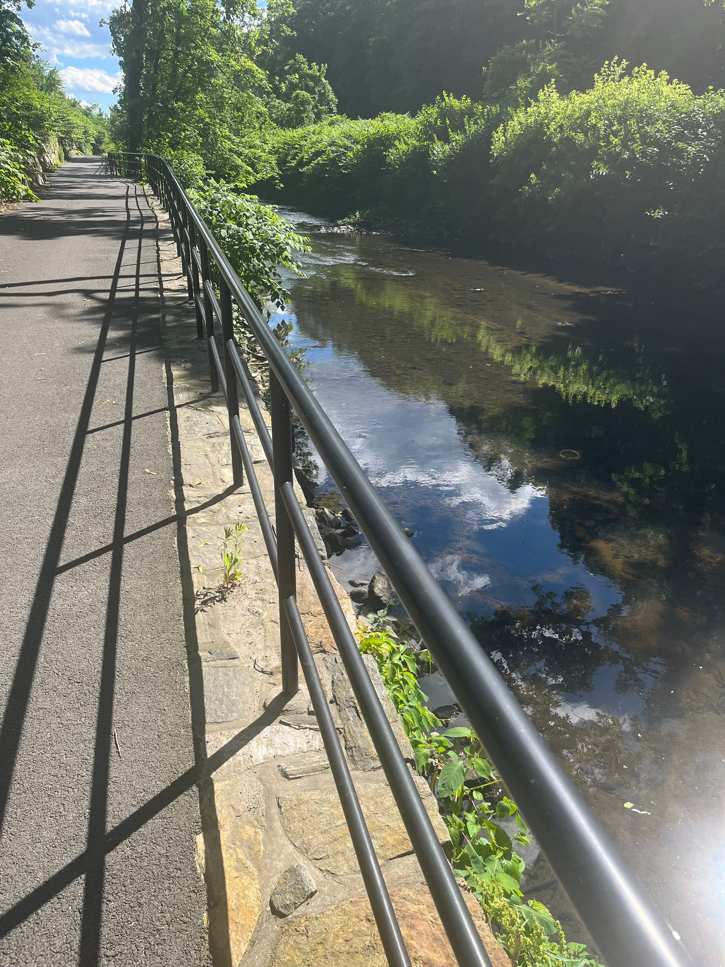
The River and the Parkway
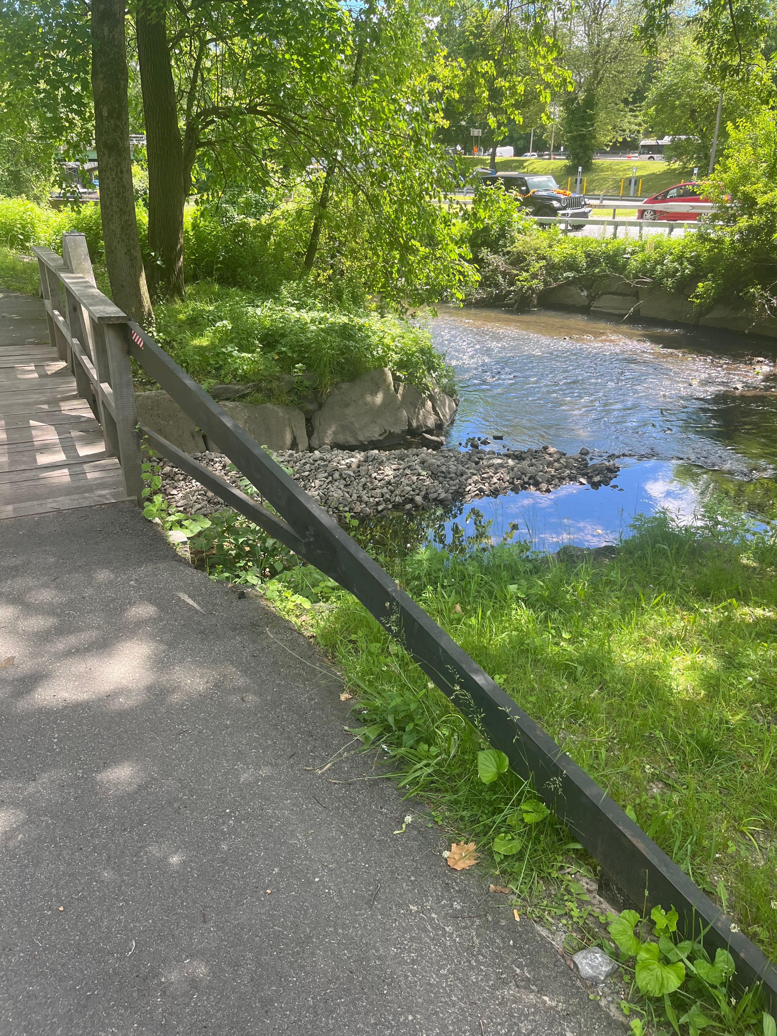
The Pathway had fewer bikers and hikers than on the OCA trail. I was never alone, though. The River and the Parkway were my constant companions.
They criss-cross each other and the Pathway, appearing first on one side, then another, and sometimes on both.
The Westchester section of the Parkway was completed in 1925. The whole thing was finished by 1952. It goes from the Bruckner Expressway in the Bronx to North Castle in Westchester, hooking up with the Taconic State Parkway.
It isn’t as intrusive as you might think. There are fewer vehicles than on a typical highway—that’s by design—so the sound of cars zipping past as you enjoy nature isn’t as prevalent. It also lies a safe distance apart from the trail. I appreciated that.
The Pathway’s official name is the Bronx River Pathway Reservation. 807 acres and 11.2 miles long, it’s Westchester’s first official park and New York State’s first linear park.
The River is twenty-four miles long. In the Bronx, it goes through Woodlawn Cemetery, the New York Botanical Garden, the Bronx Zoo and Starlight Park before emptying into the East River. The 2 and 5 trains follow it as far as Wakefield.
The towns along the trail
Another way the OCA trail spoiled me was in seeing the Hudson River towns during the hike. They were an integral part of the trail.
The Pathway is more self-contained. I couldn’t see most of the adjacent towns unless I left the trail.
Some of the towns I did see were comparable in size to the Hudson River towns. Others were bigger.
All I saw of Valhalla was a few shops along a short stretch by the train. White Plains was a city, but I saw more of it on the train ride than hiking. Most of Hartsdale’s shopping district was far removed from the greenway.
Scarsdale had fancy restaurants, but all I needed to eat was something simple. The chicken fried rice I had was mediocre. The bagel joint I wanted to visit closed early. Don’t remember Crestwood.
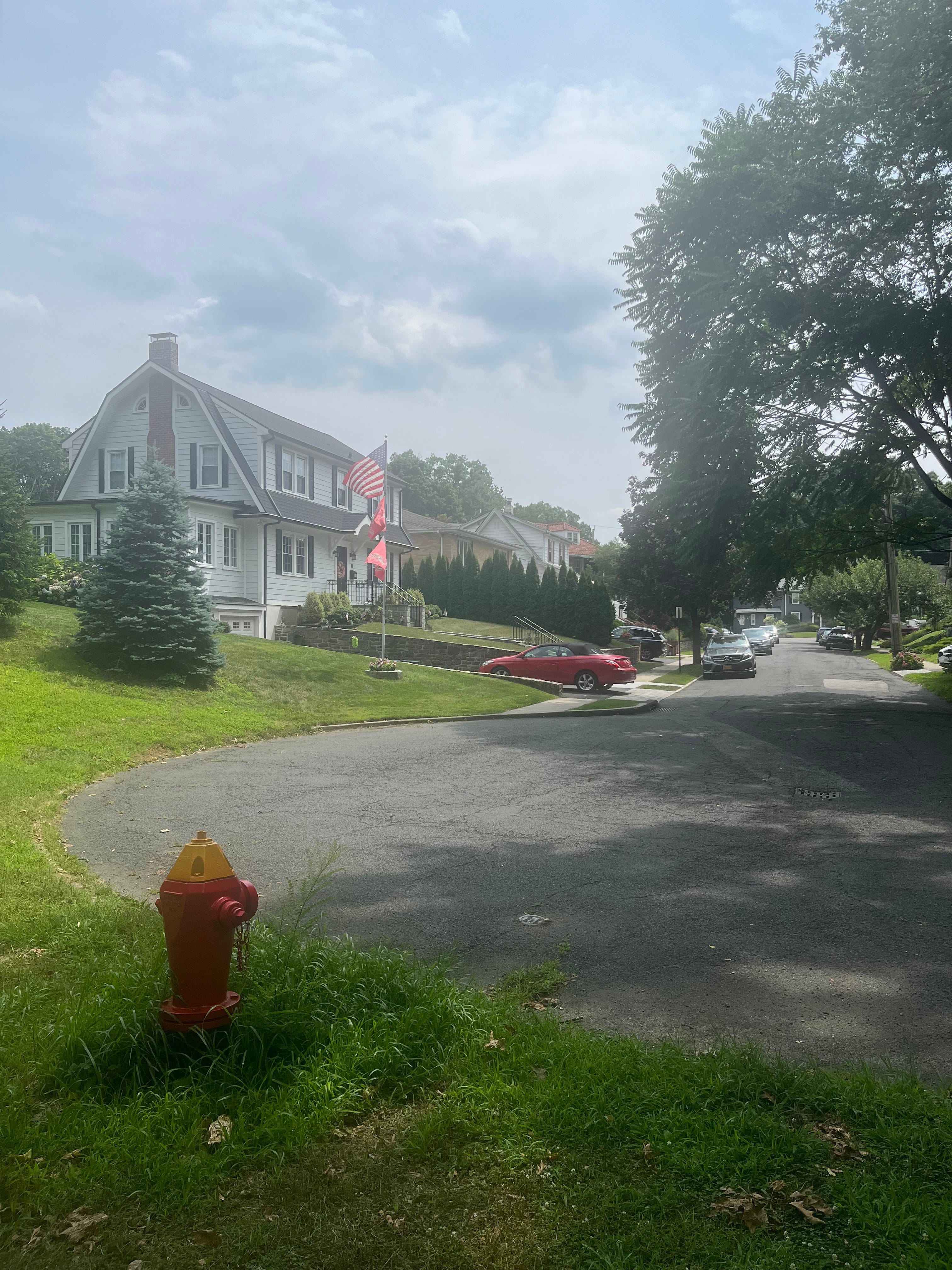
I did see more of Tuckahoe than expected. The picture heading this section was taken while still on the trail.
It leads into the shoulder of a road at one point before entering a park, next to a residential street. Lots of fancy houses like those depicted here.
I finished in Bronxville. I ate (the bagel place there was still open) and looked around their main street. Bronxville was small but posher than Hudson River towns like Scarborough or Irvington. I saw mom-and-pop shops, but corporate businesses too. There was even a movie theater. It reminded me of NYC neighborhoods like Park Slope or Bayside.
Tight squeezes

Sometimes car traffic crossed high above the trail. More often, though, the Parkway overlapped closer, creating junctions—Parkway above, River below, trail in between—that made for tight spots.
This picture is an accident. I didn’t expect the biker to come when he did. The part of the trail he came from wrapped tight around the inside wall of the arch. I had to wait for him to pass before I could walk.
Wild wild life
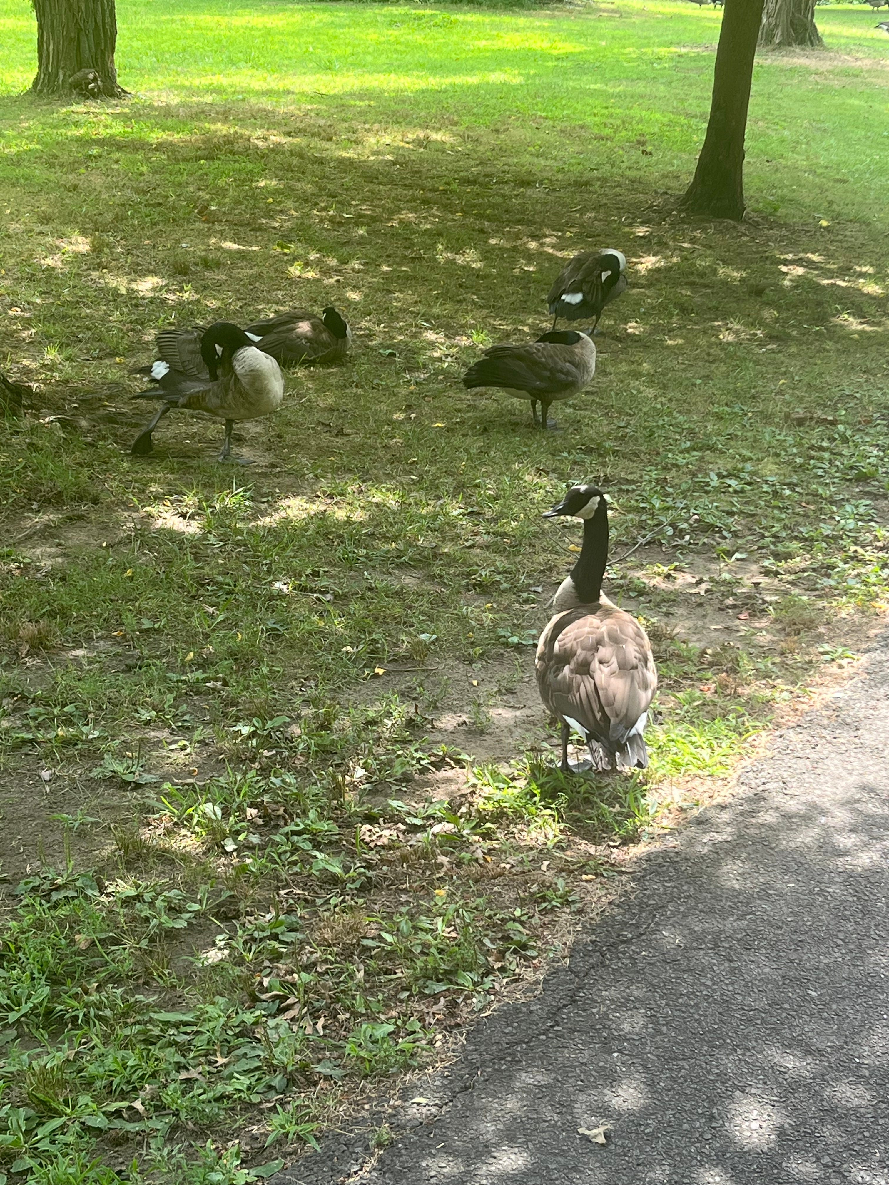
Geese appeared both along the trail and swimming in the River. Surprisingly, I didn’t see a lot of feces on the pavement of the trail.
I took shots of them in the water, but I didn’t zoom in as closely as I thought. One can see them, but they’re not very recognizable as geese.
Chasing waterfalls
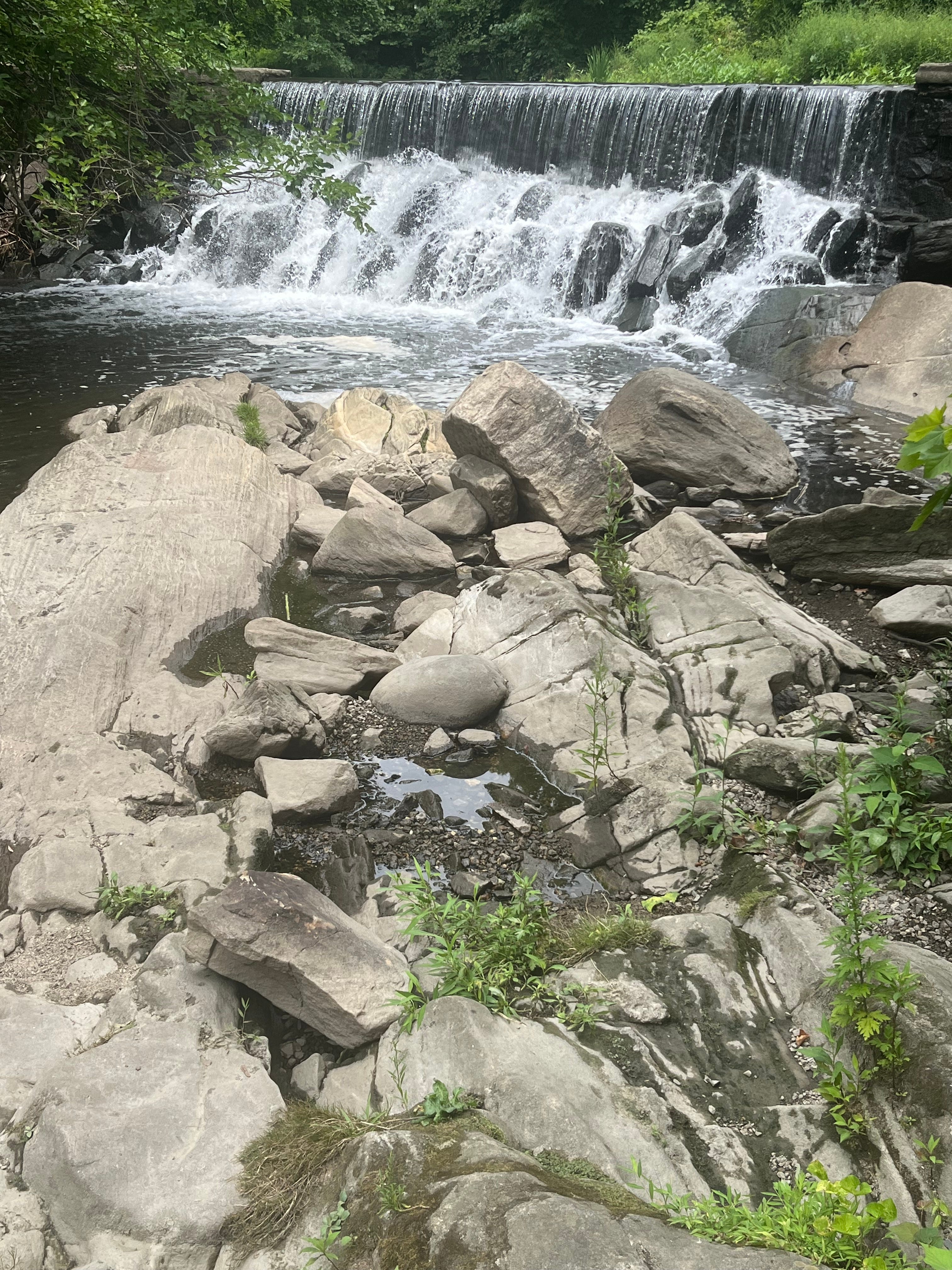
What may be the highlight of the trail, other than the Kensico Dam, is the waterfall at Scarsdale.
I didn’t see it until the second leg of my hike. I got off Metro-North at Scarsdale, found the trail after re-orienting myself, and there it was, behind the train station. I’ve seen it called both “the Waterfall at Scarsdale” and “Scarsdale Falls.”
During the eighteenth century, it was a grist and sawmill dam. Its owner, Captain Samuel Crawford, fought and died in the Revolutionary War. A plaque marks the spot where he died.
A bridge crosses the river. You can observe the falls on the bridge, but when I was there, a bunch of little kids climbed on those rocks in the foreground to get a closer look at the falls. I tried doing the same, but I felt unsteady. The last thing I wanted to do was tumble. I turned back.
Further south, I saw two smaller ones: one in Tuckahoe, the other at the Bronxville lake some call the “duck pond.”
Surprises
The number of benches increased the further south I went. I sat on one and noticed a quotation engraved on a small plaque: “If the path is beautiful, don’t ask where it leads.” The quote is attributed to someone named Andrew J. DeCecco. Google search turned up a brief obituary from Florida.
There were a few more like that, on other benches. I also saw a memorial to another absent friend, a pile of rocks surrounding a plaque, with tiny American flags all around. A different memorial was studded with flowers, tiny flags and a sculpture of a turtle.
At the Bronxville lake, I saw a pair of birdhouses. They were part of what a sign called a Native Plant Restoration Project. It’s an initiative formed by the group Bronxville Pollinator Pathways. In association with other Westchester organizations, they give pollinators, birds and insects pathways of gardens with native plants, providing habitats and sources of food. Good idea.
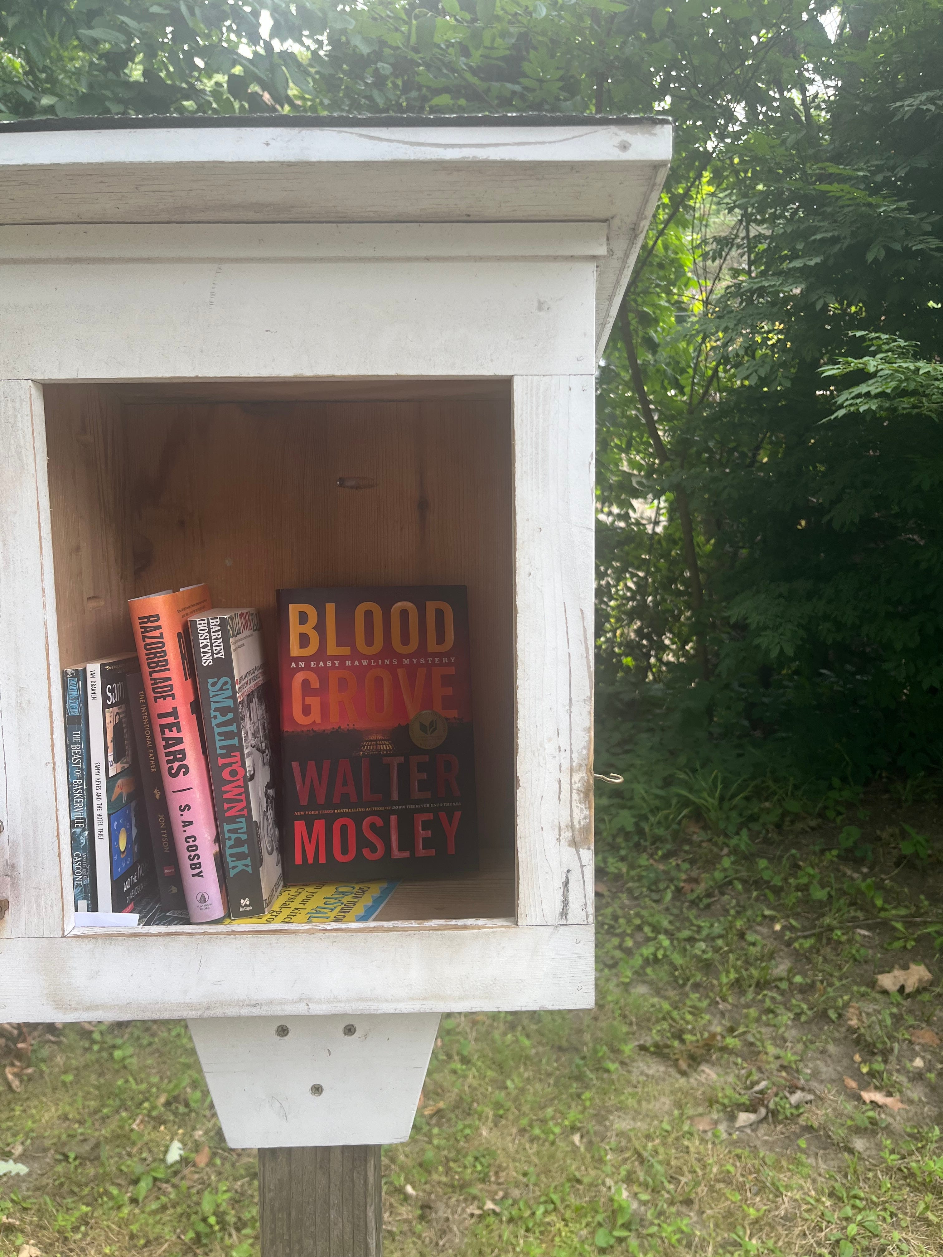
There was even a Little Free Library, on the side of the trail in Tuckahoe. Perhaps you remember the short story I posted here involving LFLs. I love the idea of providing a place to take a book for free, and to leave a book behind if you have one.
I took the Walter Mosley book and left one about writing that didn’t interest me much. I discovered it in a LFL in Brooklyn.
There’s also a separate section of the trail south of Bronxville that goes in a loop. I skipped it. I might look it at another time, but I’d seen what I wanted to see. I was ready to go home. Yet…
The 2 train seemed within range of Bronxville. At least, it looked close on Google Maps. When I bought my Metro-North ticket in Grand Central for Scarsdale, I took a chance and got it one-way. After resting in Bronxville, I planned to walk to the subway so I could save money on the ticket.
The extra mileage didn’t completely wipe me out, but I made it. I saw even fancier houses at first, then what little there was of Fleetwood and Mount Vernon West before the slums of New York City re-asserted themselves.
To top it off, weekend construction delayed and rearranged the subway in an unexpected manner, in an unfamiliar part of town. Getting home took a long time.
The Bronx River Pathway was a nice hike. I hope to go back and see stuff I missed.
@byrichwatson
***********
Have you hiked the Bronx River Pathway?