


BRW Bonus: The Old Croton Aqueduct Trail in New York City
After hiking on a trail through the Hudson Valley last year, I continue on that trail as it goes through New York City.

Last year, I completed a 26-mile hike through the lower Hudson Valley. The trail followed the course of a nineteenth-century aqueduct that used to provide water for New York City.
It was only the Westchester County portion of the trail, though. Last month I finished the 15-mile portion, in the Bronx and Manhattan.
Most of the Westchester trail was on dirt and grass, through wooded areas adjacent to small towns. The New York trail was on concrete, through big city streets.
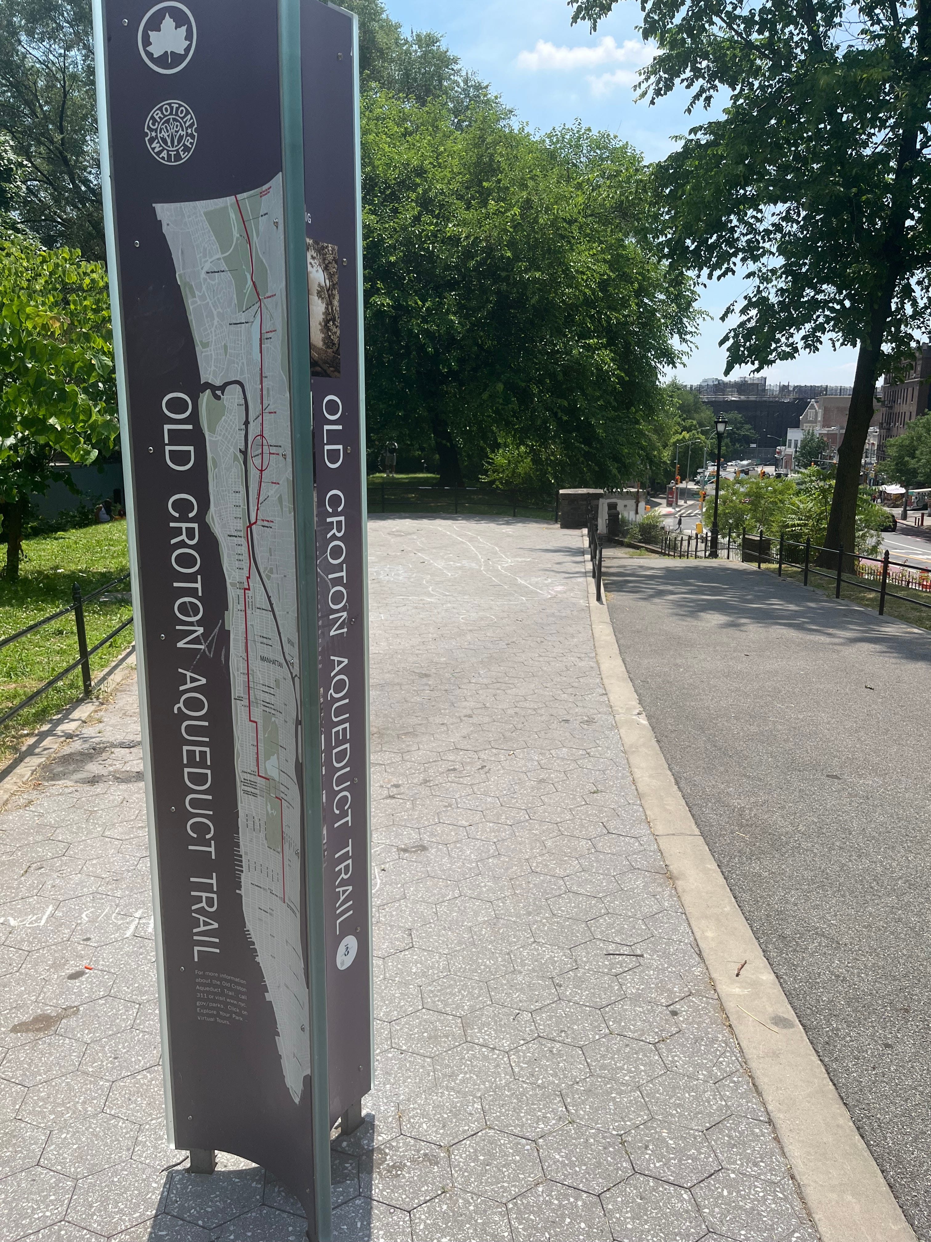
The Old Croton Aqueduct runs through both, from the reservoir in Croton-on-Hudson, down the Hudson Valley, through Van Cortlandt Park and the Bronx, over the Harlem River and into upper Manhattan, through Central Park and down to Bryant Park.
The Westchester hike took four trips. It introduced me to towns, historic buildings and natural scenery I never knew existed. The New York hike only took two trips. While not as adventurous, I saw some locations for the first time, most of it in the Bronx.
All photos are mine.
The Bronx
I used to take the Bronx for granted. Lately, I’ve begun to appreciate it better, now that I‘ve seen more of it.
The OCA trail in New York threads through Van Cortlandt Park and continues past the Jerome Park Reservoir on its east side. That’s where I began.
Jerome Park used to be a horse racing track in the 1800s. The first Belmont Stakes was held there. Leonard Jerome was an American financier. He was also Winston Churchill’s grandfather.
In 1906 the Reservoir was built for the New Croton Aqueduct.
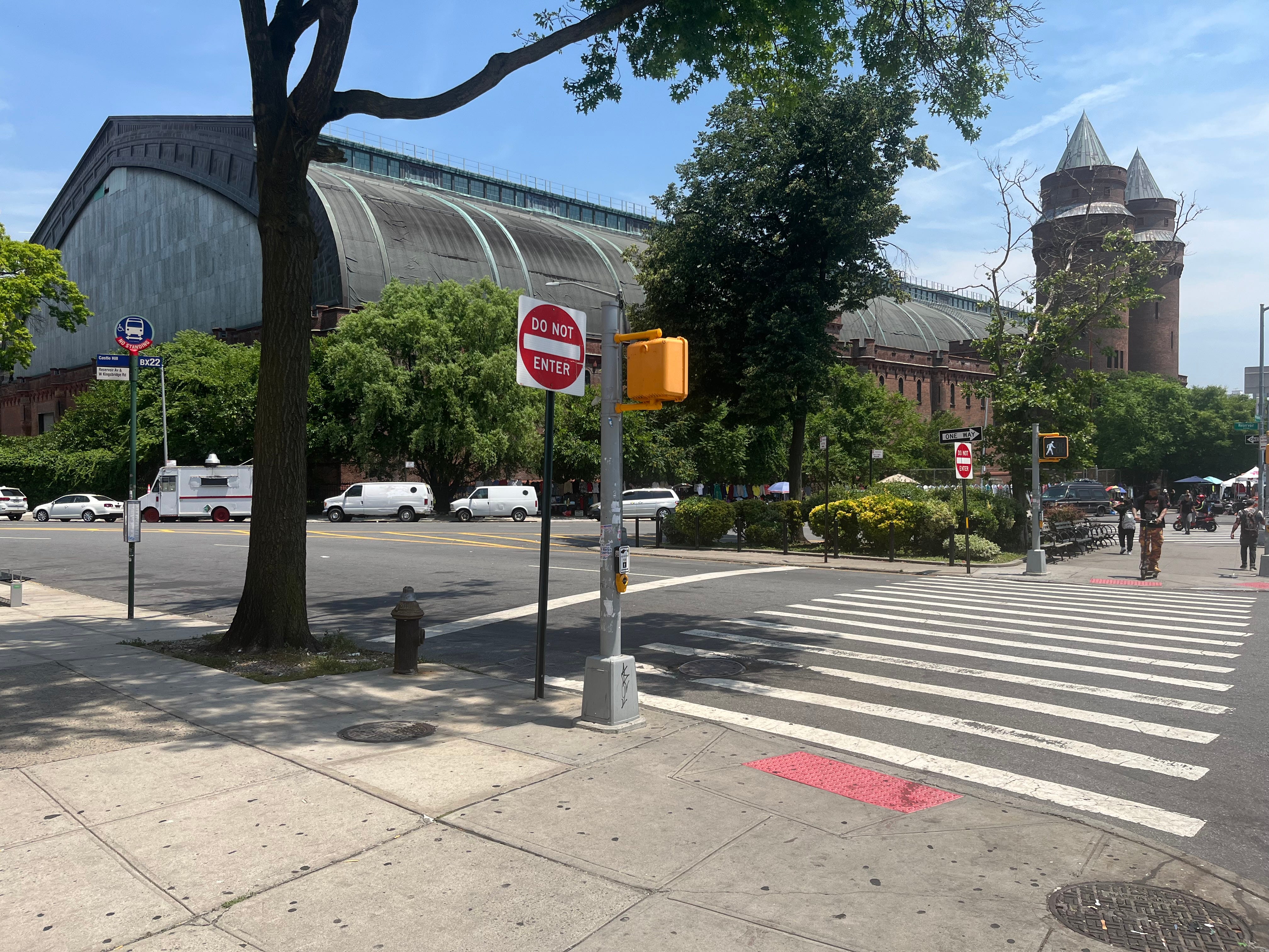
The trail goes down Goulden and Reservoir Avenues, past the Kingsbridge Armory on Kingsbridge Road (in this section’s photo) and continues through a linear park called Aqueduct Walk.
It’s a pleasant green space nestled between the street, Aqueduct Avenue, and apartment buildings, built on embankments. I saw a fair amount of locals, young and old, blasting radios and enjoying the summer sun on the Walk.
Burnside Avenue (in the photo at the top) used to have a stone bridge that carried the OCA over a roadway. When the city widened the Avenue in the twenties, the bridge was torn down and the aqueduct reconstructed. Fun fact: Burnside was named for a Civil War general who wore his beard with sideburns—hence the name.
Passing Bronx Community College, the trail goes down University Avenue. It has a string of malls in the center.
I tripped and fell at one point here—didn’t get hurt, nor did I fall into traffic, but I lost my Friends of the OCA map. Fortunately, I was close to the High Bridge. I used Google Maps to find it.
Over the High Bridge and through the park
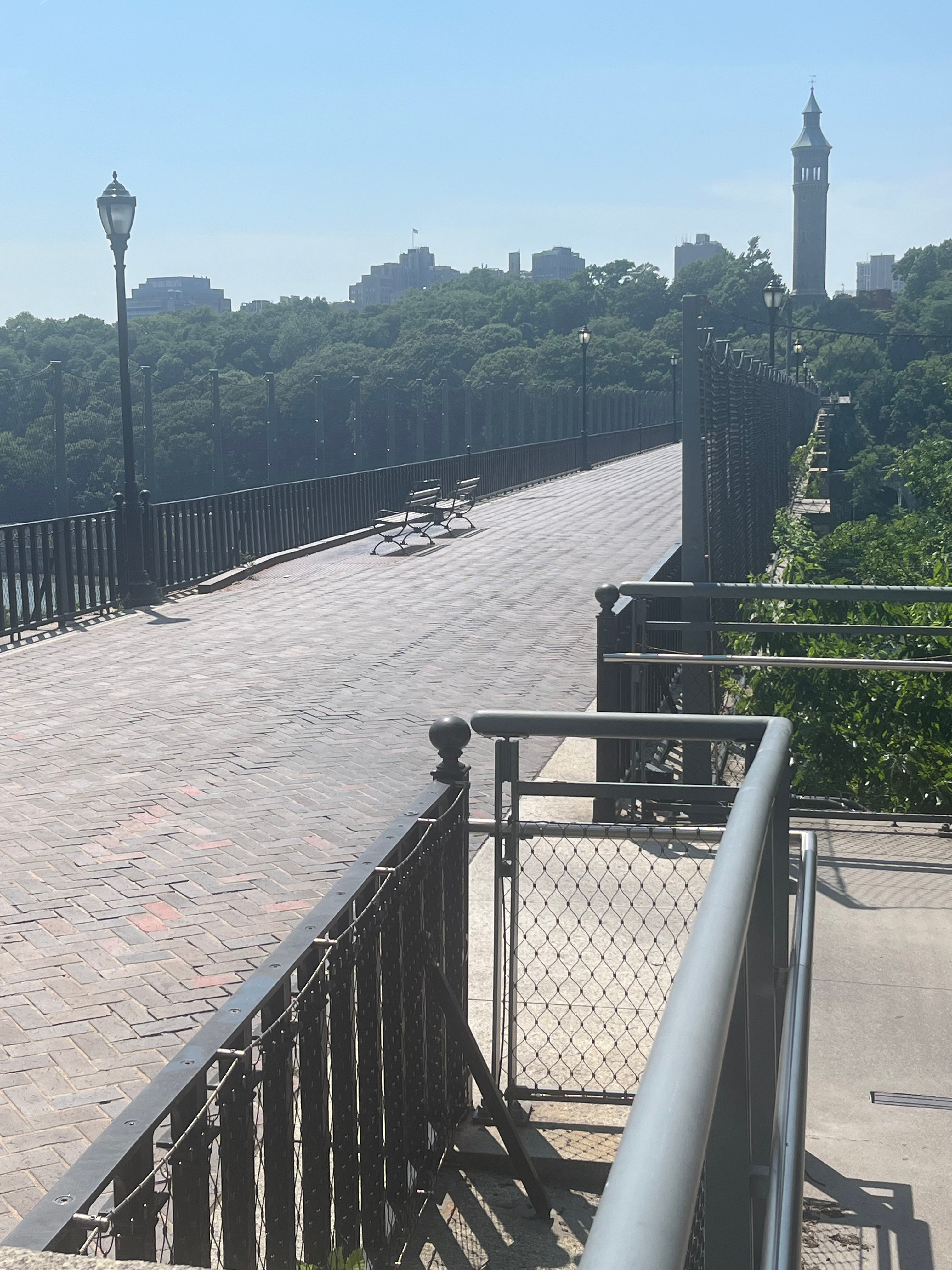
The pedestrian bridge that connects the Bronx with Manhattan is New York’s oldest bridge. It opened in 1848 as part of the OCA. It lies 140 feet over the Harlem River.
Iron pipes carried the water under the High Bridge. The 200-foot water tower on the Manhattan side carried 47,000 gallons of water in a tank fed by the OCA.
By 1949, it no longer supplied water. The Bridge closed in 1970 and reopened in 2015.
This was the first time I walked it from the Bronx side. I missed the street leading to the entrance and ended on the street under the Bridge, before I course-corrected.
The park on the Manhattan side has a paved trail. At one point it split in two paths, one leading to Edgecombe Avenue.
The other continued further into the park but it was no longer paved. In fact, it was much rockier and uneven. By that point in the day, I was hot and tired and didn’t wanna bother navigating such a path. I took Edgecombe instead.
I passed the stairway that used to lead to the Polo Grounds, off the Harlem River Drive. Willie Mays had just died at age 93, so of course I thought of this baseball legend, who played in New York before the Giants moved to San Francisco. The Harlem River Drive is co-named for him. I half-expected to see some impromptu tribute to him. I didn’t.
Upper Manhattan
For the second part of the hike, I backtracked to West 163rd Street, near the Morris-Jumel Mansion on Jumel Terrace. It was closed. Built in 1765, it is Manhattan’s oldest surviving house. Both George Washington and the British army used it at different times during the American Revolution.
I had lunch on St. Nicholas Avenue. Then I zigzagged, past Duke Ellington’s house, and west across West 153rd Street to Amsterdam Avenue, to start a long journey south to Central Park.
This part of Amsterdam was barrio territory, Spanish Harlem. Searching the Net on my phone, I discovered some things related to the OCA. For instance, there are gatehouses, at intervals along the trail, that regulate the water flow. The one at West 135th, near Convent Avenue, was built in 1890, also for the New Croton Aqueduct.
Near City College, Amsterdam slopes dramatically downward from about West 135th to West 125th. Then it heads upward again, to Columbia University.
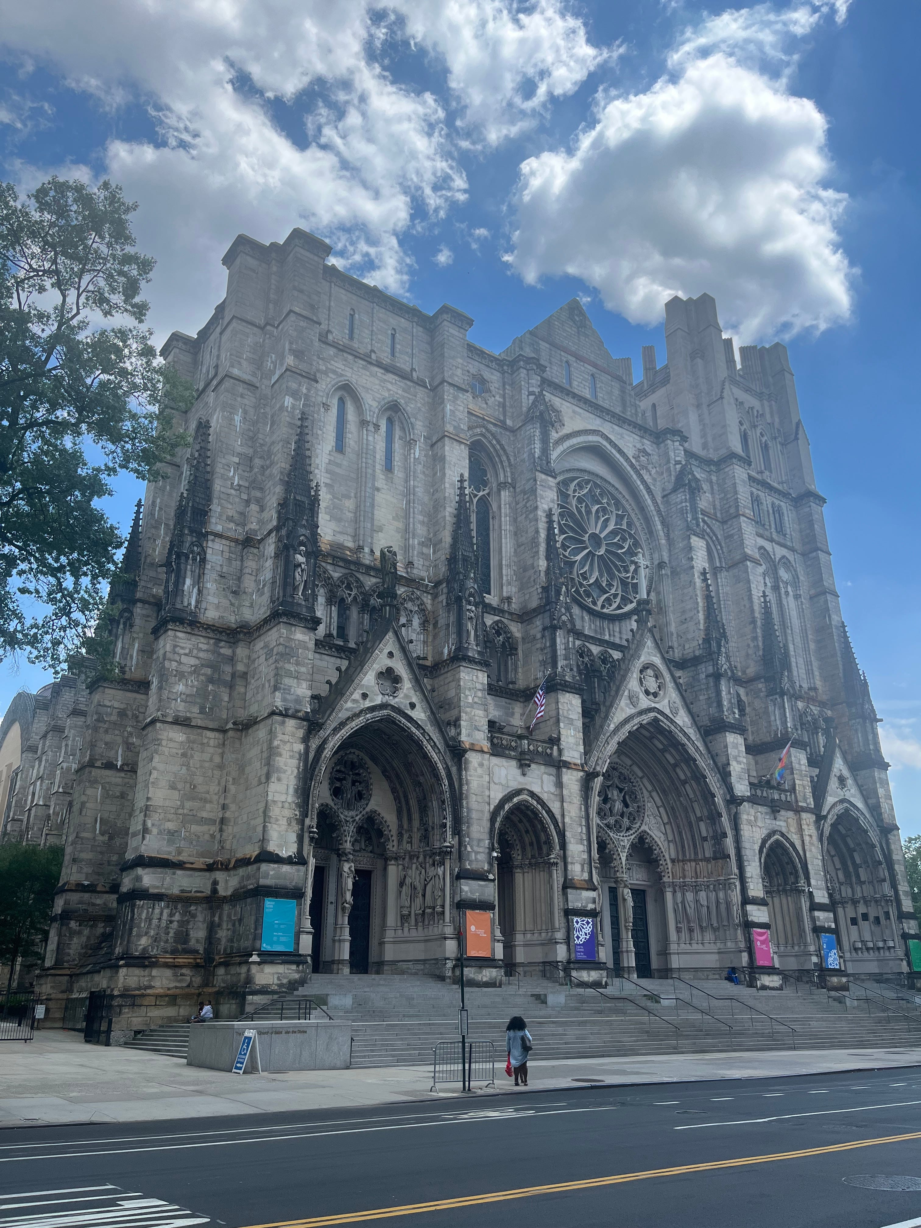
St. John’s Cathedral lies on West 110th. I recently saw, in their garden, a Public Theatre performance of Shakespeare’s The Comedy of Errors, with a Latin cast and music. The Delacorte Theatre in Central Park is undergoing renovation this year, so the company, you could say, is on the road.
I stopped to check out The Hungarian Pastry Shop, a bakery of which I had heard. I had a thick chocolate-covered biscuit. It was good.
At West 105th, the trail switched to Columbus Avenue. I followed it to West 85th and east to Central Park.
Central Park and Fifth Avenue
There was a nineteenth-century manhole at West 85th, from which one could access the OCA, but it’s been replaced now.
This entrance to Central Park leads to the former site of Seneca Village, a settlement of free black people from the early 1800s, pre-dating the park itself. When the OCA was completed, an above-ground receiving reservoir was nearby, maintained by Irish immigrants who lived in SV.
The south end of the Jacqueline Kennedy Onassis Reservoir is also close. Holding one billion gallons of water, it was also part of the OCA water distribution system. In 1993, the city, deeming it obsolete, decommissioned it. A year later, it was named for the former First Lady, who lived on Fifth Avenue, overlooking the reservoir, and often jogged around it.
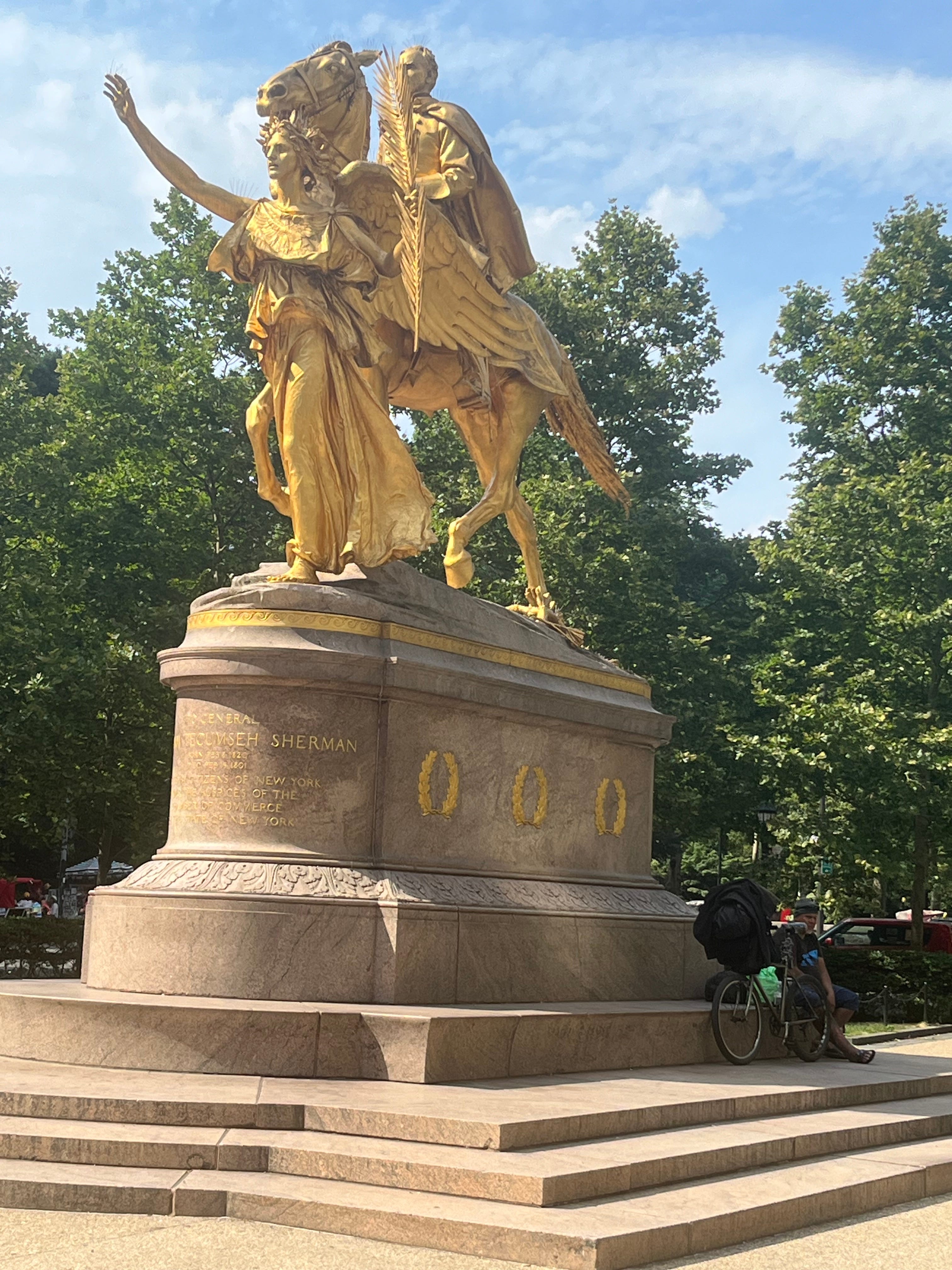
I didn’t stay in the Park long. I took advantage of the water fountains, because it was that kind of day, and continued south and east, past Cleopatra’s Needle and the Metropolitan Museum of Art, to Fifth Avenue. Once I reached Grand Army Plaza on Central Park South (in the photo in this section), the rest was a stroll to the New York Public Library and Bryant Park through the ever-busy midtown area, past St. Patrick’s Cathedral and Rockefeller Plaza.
And that was it.
The Park was unofficially called Reservoir Square, then officially named for newspaper editor and abolitionist William Cullen Bryant when it opened in 1847. The city built the distributing reservoir, also above-ground, on the eastern end of the site because it was higher. The library came along in 1895.
Water first flowed through the OCA on June 22, 1842. When it opened to the public on October 14, the city held a day-long party. In 1890, the completed, new aqueduct had three times the capacity of the OCA. The city drained and filled the receiving reservoir to make Central Park’s Great Lawn. The OCA continued serving New York until 1955. In 1987, it reopened to provide water for Ossining.
In 1968, New York State bought the land in Westchester County which contained the OCA trail and made it a state historic park.
At the library, I snapped a few pictures of the lion statues and took the subway back to Queens because I was really tired.
I hope to go on more hikes, in Westchester and Nassau Counties, in the future. I dug this kind of thing more than I thought I would.
@byrichwatson
—————
Have you hiked the Old Croton Aqueduct trail?
I understand it’s a popular hotspot. When I was there it was packed.
Years ago, the Hungarian Pastry Shop was my favorite writing spot, just steps away from where I used to live. And I wrote my first screenplay there.